Venezuela Earthquake Destruction Revealed in New Satellite Images
Using imagery collected by Sentinel satellites and sensors, the system has generated 10 products and 25 maps that enable real-time assessment of the extent of damage and how terrain has shifted in 13 areas of interest. The report notes that, as of June 27, an estimated nearly 1,300 buildings have been affected in the region.A satellite map created by the Copernicus system identifies areas severely affected in Venezuela following the earthquakes of June 24, 2026. Red dots indicate areas with a greater than 75 percent probability of damage.
- ▪Using imagery collected by Sentinel satellites and sensors, the system has generated 10 products and 25 maps that enable real-time assessment of the extent of damage and how terrain has shifted in 13 areas of interest.
- ▪The report notes that, as of June 27, an estimated nearly 1,300 buildings have been affected in the region.A satellite map created by the Copernicus system identifies areas severely affected in Venezuela following the earthquakes of June 24
- ▪Red dots indicate areas with a greater than 75 percent probability of damage.
Opening excerpt (first ~120 words) tap to expand
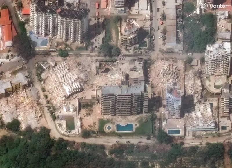
Fernanda GonzálezScienceJun 30, 2026 5:30 AMSatellite Images Show the Destruction Caused by Venezuela’s Twin EarthquakesThe maps and images show the extent of destruction and give rescue operations a tool to find any remaining survivors.A satellite image from Vantor shows collapsed apartment buildings and widespread damage caused by the earthquake in the Playa Grande neighborhood of La Guaira.Satellite image (c) 2026 Vantor/Maxar/Getty ImagesCommentLoaderSave StorySave this storyCommentLoaderSave StorySave this storySatellite Technology Is being used to streamline rescue efforts in Venezuela following the two earthquakes that struck on June 24.
…
Excerpt limited to ~120 words for fair-use compliance. The full article is at WIRED.
Discussion
0 commentsMore from WIRED