PCB Map Display Keeps An Eye On Family
A new PCB map display has been created to visually represent the California East Bay area. This innovative design incorporates an RGB LED array that lights up based on the location data of family members' mobile devices. The project is available for others to replicate through shared files on GitHub.
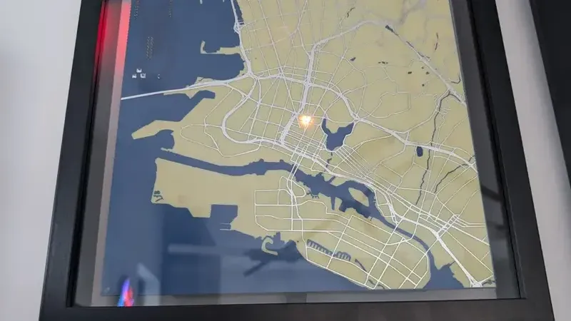
- ▪The PCB map features roads laid out as the top-side copper layer.
- ▪A 64 x 32 RGB LED array is mounted behind the PCB to illuminate locations.
- ▪The ESP32 controls the LEDs by receiving location data via MQTT.
Opening excerpt (first ~120 words) tap to expand
PCB Map Display Keeps An Eye On Family No comments by: Zoe Skyforest May 23, 2026 Title: Copy Short Link: Copy PCBs are traditionally designed with traces laid out to support a circuit full of electronic components. However, they’ve become increasingly popular as a way to produce functional visual artworks. This PCB map from [Jonathan] is a great example. The PCB was designed as a map of the California East Bay area. The roads are laid out as the top-side copper layer, while the land and roads are used for the top solder mask layer, with the flipped land and roads area making up the solder mask on the bottom side. The map data itself was cribbed from Snazzy Maps. Behind the PCB, [Jonathan] mounted a 64 x 32 RGB LED array, which can be seen glowing through from behind the material.
…
Excerpt limited to ~120 words for fair-use compliance. The full article is at Hackaday.
Discussion
0 commentsMore from Hackaday