Google Maps Just 'Unburned' the Pacific Palisades — and Infuriated Angelenos Noticed
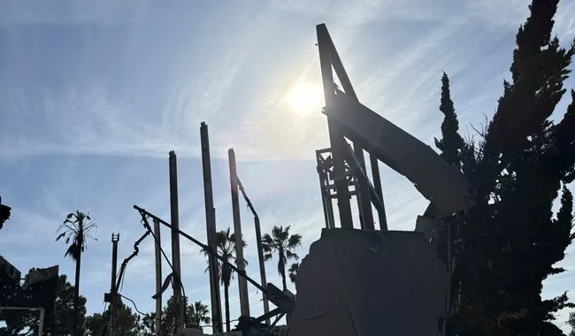
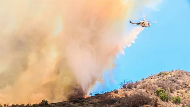
Google Maps has reverted to showing outdated satellite imagery of the Pacific Palisades and Altadena, depicting these areas as untouched by the devastating fires of January 2025. This change has sparked frustration among Angelenos, who are concerned about its implications for navigation and recovery efforts. Users have taken to social media to express their confusion and seek answers from Google regarding this apparent oversight.
- ▪Google Maps is displaying pre-fire images of the Pacific Palisades and Altadena, despite the areas being severely damaged by wildfires.
- ▪Residents have raised concerns about the accuracy of the maps affecting navigation and recovery efforts.
- ▪The wildfires in January 2025 caused significant destruction, resulting in the loss of over 16,240 homes and businesses.
Opening excerpt (first ~120 words) tap to expand
Google Maps Just 'Unburned' the Pacific Palisades — and Infuriated Angelenos Noticed By Bob Hoge | 6:15 AM on May 16, 2026 The opinions expressed by contributors are their own and do not necessarily represent the views of RedState.com. Pacific Palisades, February, 2025. (Credit: Roxanne Hoge) Angelenos have been noticing something strange: the Google Maps satellite imagery depicting the Los Angeles areas of the Pacific Palisades and Altadena now shows pristine neighborhoods untouched by the devastating fires of January 2025. Advertisement googletag.cmd.push(function () { googletag.display("div-gpt-300x250_2"); //googletag.pubads().refresh([gptAdSlot["div-gpt-300x250_2"]]) }); Of course, as we all know, those neighborhoods are in ruins.
…
Excerpt limited to ~120 words for fair-use compliance. The full article is at RedState.
Discussion
0 commentsMore from RedState